Previsione meteo - Ankogel
Previsione meteo Ankogel:
Aggiornato: 18. 11. 2026 18:58
|
| | 2h |
| |  |
| Temperatura: | -10 °C |
| Precipitazioni (mm/h): | 0 |
| Nuvolosità: | 98% |
|
| 5h |
 |
| -11 °C |
| 0 |
| 62% |
|
| 8h |
 |
| -10 °C |
| 0,06 |
| 22% |
|
| 11h |
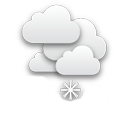 |
| -8 °C |
| 0,3 |
| 62% |
|
| 14h |
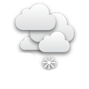 |
| -9 °C |
| 0,66 |
| 76% |
|
| 17h |
 |
| -11 °C |
| 0 |
| 38% |
|
| 20h |
|
| -11 °C |
| 0 |
| 41% |
|
| 23h |
|
| -11 °C |
| 0 |
| 32% |
|
|
| | 2h |
| | |
| Temperatura: | -11 °C |
| Precipitazioni (mm/h): | 0 |
| Nuvolosità: | 5% |
|
| 5h |
 |
| -11 °C |
| 0 |
| 88% |
|
| 8h |
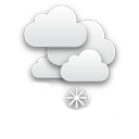 |
| -11 °C |
| 0,38 |
| 99% |
|
| 11h |
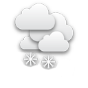 |
| -13 °C |
| 1,56 |
| 100% |
|
| 14h |
|
| -11 °C |
| 0,54 |
| 100% |
|
| 17h |
|
| -12 °C |
| 0,07 |
| 91% |
|
| 20h |
|
| -13 °C |
| 0 |
| 59% |
|
| 23h |
|
| -13 °C |
| 0 |
| 35% |
|
|
| | 2h |
| | |
| Temperatura: | -12 °C |
| Precipitazioni (mm/h): | 0 |
| Nuvolosità: | 100% |
|
| 5h |
|
| -13 °C |
| 0 |
| 48% |
|
| 8h |
|
| -12 °C |
| 0 |
| 62% |
|
| 11h |
|
| -11 °C |
| 0 |
| 100% |
|
| 14h |
|
| -13 °C |
| 0,04 |
| 85% |
|
| 17h |
|
| -13 °C |
| 0 |
| 84% |
|
| 20h |
|
| -14 °C |
| 0 |
| 99% |
|
| 23h |
|
| -14 °C |
| 0 |
| 99% |
|
|
| | 2h |
| | |
| Temperatura: | -15 °C |
| Precipitazioni (mm/h): | 0,06 |
| Nuvolosità: | 100% |
|
| 5h |
|
| -15 °C |
| 0 |
| 99% |
|
| 8h |
|
| -14 °C |
| 0,18 |
| 80% |
|
| 11h |
|
| -11 °C |
| 0,3 |
| 81% |
|
| 14h |
|
| -11 °C |
| 0,14 |
| 78% |
|
| 17h |
|
| -15 °C |
| 0,06 |
| 59% |
|
| 20h |
|
| -16 °C |
| 0 |
| 34% |
|
| 23h |
|
| -15 °C |
| 0 |
| 54% |
|
|
| | 2h |
| | |
| Temperatura: | -15 °C |
| Precipitazioni (mm/h): | 0 |
| Nuvolosità: | 89% |
|
| 5h |
|
| -15 °C |
| 0 |
| 100% |
|
| 8h |
|
| -14 °C |
| 0,04 |
| 100% |
|
| 11h |
|
| -11 °C |
| 0,08 |
| 99% |
|
| 14h |
|
| -11 °C |
| 0,08 |
| 99% |
|
| 17h |
|
| -12 °C |
| 0,32 |
| 100% |
|
| 20h |
|
| -13 °C |
| 0,32 |
| 100% |
|
| 23h |
|
| -14 °C |
| 0,24 |
| 100% |
|
Previsione meteo per la località Ankogel. Ankogel è un montagna nella catena montuosa Alti Tauri (
Austria) a un'altitudine di 3252 metri sul livello del mare.
Webcam nelle vicinanze
km:
Ankogel,
Auernig,
Bad Gastein (FlyingCam),
Bad Gastein (Graukogel Bergstation),
Bad Gastein (Stubnerkogel Bergstation Südseite),
Bad Gastein nella valle di Gastein - Hotel Schillerhof,
Flattach Ovest,
Hüttschlag,
Kreuzkogel (Sportgastein),
Mallnitz,
Obervellach,
Söbriach (Mölltal Straße),
Stubnerkogel (Snowpark),
Thomaseck
Montagne nelle vicinanze
km:
Panorami nelle vicinanze
km:
Previsione meteo sul vostro sito web