Previsione meteo Zečak:
Aggiornato: 9. 11. 2026 21:53
|
| | 2h |
| |  |
| Temperatura: | 2 °C |
| Precipitazioni (mm/h): | 0 |
| Nuvolosità: | 83% |
|
| 5h |
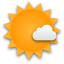 |
| 2 °C |
| 0 |
| 36% |
|
| 8h |
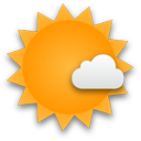 |
| 4 °C |
| 0 |
| 8% |
|
| 11h |
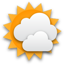 |
| 7 °C |
| 0 |
| 64% |
|
| 14h |
 |
| 7 °C |
| 0 |
| 100% |
|
| 17h |
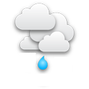 |
| 6 °C |
| 0,2 |
| 100% |
|
| 20h |
|
| 6 °C |
| 0,59 |
| 100% |
|
| 23h |
|
| 7 °C |
| 0,09 |
| 99% |
|
|
| | 2h |
| | |
| Temperatura: | 7 °C |
| Precipitazioni (mm/h): | 0 |
| Nuvolosità: | 100% |
|
| 5h |
|
| 8 °C |
| 0,2 |
| 99% |
|
| 8h |
|
| 9 °C |
| 0,09 |
| 99% |
|
| 11h |
 |
| 11 °C |
| 0 |
| 89% |
|
| 14h |
|
| 11 °C |
| 0 |
| 100% |
|
| 17h |
|
| 11 °C |
| 0,09 |
| 100% |
|
| 20h |
 |
| 11 °C |
| 1,44 |
| 100% |
|
| 23h |
|
| 9 °C |
| 3,89 |
| 100% |
|
|
| | 2h |
| | |
| Temperatura: | 6 °C |
| Precipitazioni (mm/h): | 2,29 |
| Nuvolosità: | 100% |
|
| 5h |
|
| 6 °C |
| 0 |
| 100% |
|
| 8h |
|
| 7 °C |
| 0 |
| 100% |
|
| 11h |
|
| 9 °C |
| 0 |
| 100% |
|
| 14h |
|
| 10 °C |
| 0,49 |
| 100% |
|
| 17h |
|
| 10 °C |
| 0,09 |
| 100% |
|
| 20h |
|
| 10 °C |
| 0,8 |
| 100% |
|
| 23h |
|
| 10 °C |
| 3 |
| 100% |
|
|
| | 2h |
| | |
| Temperatura: | 10 °C |
| Precipitazioni (mm/h): | 0,19 |
| Nuvolosità: | 100% |
|
| 5h |
|
| 10 °C |
| 0,09 |
| 100% |
|
| 8h |
|
| 11 °C |
| 0,4 |
| 100% |
|
| 11h |
|
| 12 °C |
| 0,31 |
| 100% |
|
| 14h |
|
| 13 °C |
| 0,3 |
| 100% |
|
| 17h |
|
| 12 °C |
| 0,69 |
| 100% |
|
| 20h |
|
| 12 °C |
| 1,33 |
| 100% |
|
| 23h |
|
| 11 °C |
| 1,33 |
| 100% |
|
|
| | 2h |
| | |
| Temperatura: | 12 °C |
| Precipitazioni (mm/h): | 1 |
| Nuvolosità: | 100% |
|
| 5h |
 |
| 12 °C |
| 0,2 |
| 83% |
|
| 8h |
 |
| 13 °C |
| 1,2 |
| 88% |
|
| 11h |
|
| 10 °C |
| 1,2 |
| 98% |
|
| 14h |
|
| 7 °C |
| 1,7 |
| 100% |
|
| 17h |
|
| 5 °C |
| 1,7 |
| 100% |
|
| 20h |
|
| 3 °C |
| 1,4 |
| 100% |
|
| 23h |
 |
| 0 °C |
| 1,4 |
| 100% |
|
Previsione meteo per la località Zečak. Zečak è un montagna nella catena montuosa Žumberačka gora, Medvednica e Međimurje (
Croazia) a un'altitudine di 795 metri sul livello del mare.
Webcam nelle vicinanze
km:
Montagne nelle vicinanze
km:
Panorami nelle vicinanze
km:
Previsione meteo sul vostro sito web